
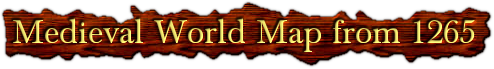
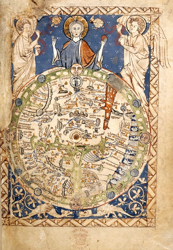
This map is one of the most important surviving examples of 13th-century map-making.
It tells us much about the way English men and women viewed the world at this time.
Jerusalem is in the centre of the map, and the whole world is looked upon by Christ who is attended by angels.
This shows that medieval people looked at geography in relation to the Bible and to earth’s creation by God.
But the map also shows an interest in local places: you can see the British Isles, and the rivers Thames and Severn.
London is marked with a gold dot. The map was not intended, like a modern atlas, to guide someone in their travels,
but to show important places in an overall scheme.
SEE FULL SIZE
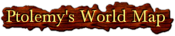
Ptolemy (c.100-178) was a hugely important geographer and astronomer working in Ancient Rome.
This map takes valuable information from his famous book Geographia.
His work informed mapmakers on the size of the Earth,
and the co-ordinates for the positions of all the places and features indicated on the map.
Until a copy of Geographia was translated from Greek into Latin in 1407, all knowledge of these co-ordinates
had been lost in the West. The book created a sensation, as it challenged the very basis of medieval
mapmaking – mapmakers before this had based the proportions of countries, not on mathematical calculations,
but on the importance of different places - the more important a country was, the bigger it appeared on the map.
In fact, many of Ptolemy’s calculations were later proved to be incorrect.
However, the introduction of mathematics and the idea of accurate measurement were to
change the nature of European mapmaking forever.
This copy of Ptolemy's World Map was produced slightly later, in 1482.
SEE FULL SIZE
TODAY


|
1600 -1700
|
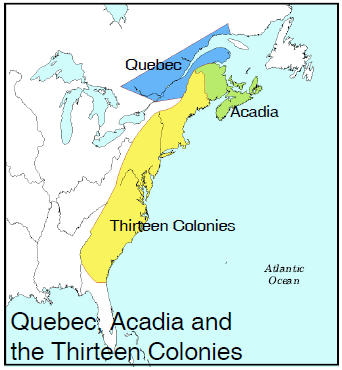
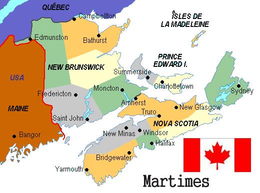
Acadia Today
|